Thursday, November 26, 2009

3D website is the new frontier of digital mapping and rich internet experience


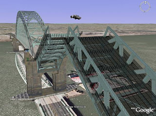
First the Google Earth, then comes plug-ins to have the Google Earth on your website followed by extensive kml and tour embeding options on your BROWSER. Yes, the 3D digital mapping is kicking off, very quickly starting from desktop application to your browser...the armchair cartographers and enthusiasts can be the virtual Columbus reaching every corners of the globe just by downloading some plug-ins!

Of course, it is not cheap to have spatial information in 3D from all over the world, so there is a very popular solution: crowd sourcing. Google has been doing it through the introduction of Sketch up, and now building maker (very powerful tool), where Microsoft has tried some options like Truespace and turned back to professional help from their own team in pursuit of the 3D cities. The competitions grow and so do the 3D virtual cities.

In an attempt to provide true (actual height plus some errors) 3D experience, a project called skape (not Skype) is another example of a struggle to attract more "users" in the virtual 3D world. Skape is getting Lidar data (with height information) in order to have true height of urban areas that will particularly benefit municipalities, environmental planners (at least they claim it) and of course, people like you and me!

Those are just the examples from the spatial world. Yes they were there before...but just arrived on your browser recently. More importantly, you will have the real 3D web browsing experience soon, Google, the giant, has recently (not that recently though) released O3D web api that allows you to create rich and interactive 3D applications in the browser. There you go!

Thursday, August 13, 2009

Google Earth Vs Bhuvan: Is Sanskrit Digital Earth a new rival to Google Earth?

Indian Space Agency released a beta version of Bhuvan today. It is named as an answer to Google Earth in blogsphere and GIS international news. Bhuvan in sanskrit (the oldest languge, from which Hindi, Nepali and some other regional languages evolved) means "Earth". The virtual earth is no more a Google Earth, it is just the Earth now when it comes to the digital world. Digital earth or Bing with its unique 3D capability, specially with Microsoft's own staff instead of crowd sourcing, is gaining more popularity. However, Google Earth has already become the everyday phenomena in "general Google it" public. In the crowd of these two major industry players, Bhuvan is a leap from the Indian Governmental presence in the digital world which also shows that India is now ready to "show off" its technical capability outside of "Outsouring Area".
Bhuvan contains very high resolution imagery in most part of India, and has high to medium resolution imagery of the world taken from various satellites including Cartosat-1 and Cartosat-2. Hosted from www.bhuvan.nrsc.gov.in, it can be a great success as this will have multilayer images and will be updated every year unlike Google Earth which updates about every four year, depending on the location.

Catch, I tried accessing the website, due to "high numbers of users on the site" , I really could not go too further. Maybe it was the bad time on the day. Anyway, I did discover that you need to fill out a mandatory form and have a user name for Bhuvan. I don't see it as a rival to Google or Digital Earth at any sense, however, the attempt to provide multi-resolution imagery for the people in those region is praiseworthy, as they are not as common as in North America and Europe. Keep in mind, it is still in beta version!!!I will update on the quality of it whenever I access it successfully!

Yes, like Google Earth and Digital Earth, Bhuvan also has the 3D capability!!!

Friday, July 3, 2009

3 Steps to Synchronize Google Earth with ArcMap

In one of my earlier posts, I had written about how to synchronize two or multiple maps. I came to know that most of you are interested in synchronizing Google Earth with ArcMap. Now, I thought I should let you know about this script/tool that can be used in order to synchronize Google Earth with ArcMap. This script is developed by Luiz Motta, and I found this as a public domain from ESRI website. When I say script, you might think...not my thing! That's not true..you don't need to do anything. The author of the script has created a very good documentation and all you need to know is copy and paste.
Basic requirements:
1. ArcMap 8.2 or higher (Although I have tested only in 9.1, .2 and .3)
2. Google Earth installed in your machine (any version..i believe..i tested in 4 and 5, and it works)
3. You should be detail-oriented and able follow the instructions thoroughly (No programming required).

How to synchronize? Three Steps:
1. Download the zip file from here.
2. Open ArcMap and follow the instructions from the pdf file.
3. Select either Google Earth or ArcMap tab in order to zoom to the areas of your interest from both platform (Google and ArcMap) at the same time.
See the image below to get an idea how it should look:


There you go!!! It is that easy. It might take about 15 minutes for you to copy, paste and follow the instructions. Great script, however you can not digitize (to my knowledge) in both platforms by digitizing or editing one of them. Share your thoughts about what you think!

Wednesday, June 3, 2009

Spatially Important Earth- Part 2: End of Civilization Coming Soon?

How long do you think the recession will affect you? If no measures are taken, the recession would be just a mere glitch to the already degrading environmental problems that we are facing today. A “mere” glitch can help fuel global warming leading the catastrophic end of the civilization according to “Earth2100” a documentary that was broadcast on June 2nd, 2009 from 9 pm to 11pm eastern on American Broadcasting Company (ABC).
Very well animated future features an ordinary Lucy, American child, girl, woman and the wise lady, as a spokesperson of the depressing future. The future is characterized in four major phases. First, a concession that does not reach on global warming in 2015 when the fossil fuels will be harder to find and more expensive to consume, therefore, further economic meltdown; second by 2030, two third of the world population will be adversely influenced by the rainfall pattern, therefore, basic need water would start becoming scarce; third by 2050, the world population could take major U turn with the increased world population by approximately 9 billion, sea level rise will force the world map to redrawn; forth, continuous drought, lack of food resources for the world to depend and see level rise up to few meters might flood major cities like New York displacing reducing total world population around 3 billion by 2100, if no measures are taken. The documentary does not refer “economic recession” as a key to the end of the civilization; however the global warming and the need of economic development in the third-world and the emerging industrial powers like China and India might go hand by hand, therefore, posing more threats to global concession climate change.
The documentary is excellent in its “awakening call”. It makes you feel that it might actually be possible. The details on the facts and the quotes used in the documentary can be found in the official site of ABC channel. Lucy, an Emergency Medical Technician (EMT) at a hospital does her best to help protect the future but ends up losing her husband, an engineer devoted to protect New York City by building a see barrier and her son-in-law as a product of initial aftermath of ever-increasing global warming. Not to mention the characterization of the overall “worst case scenario”, the documentary does an excellent job at prostrating how the “mob movement” will force the remaining “clean and sustainable” world to turn into an avoidable chaos. Therefore, there is no safe place anywhere on earth if a big disaster, like global island takes place. Documentary does show the better future, if measures are taken right now. It is up to you to choose which future you want to see.
Overall, the message is the civilization might end in next century if we fold our hands now. The ideas are not new. This can be categorized and another Al Gore documentary, however the fact and storytelling with the animated future has taken the visual reference to things we do not want to envision in our lifetime. As nothing can be predicted accurately given the nature of our existence, natural forces and scientific breakthrough, the documentary has done great job at showing the “what if” scenario.
One of the major drawbacks is that the scientific achievement, research, positive initiatives like that of the metropolitan Washington DC, New York, Toronto where green roofs and streets, bike- sharing concepts are completely ignored. Even if there is the worst case scenario, the little thing already done from little community can moderate the global warming if not eradicate. Overall, the achievable heavenly future on the other hand rolls the dice in the documentary Earth2100 where “nothing is impossible if human wishes with positive hearts and spirits”.


Easter Island is an excellent metaphor for how people used up the last tree in order to feed themselves and ended up dying. The world is moving towards the same scenario. It is not the fact that we consume natural resources, it is the fact that we are not moving forward fast enough to protect what we have left. The sustainability is another issue that is overlooked.
The documentary refers the developed nations to take lead in the development and deployment of the green technology so that the third world countries can benefit from it. Being the owner of the technology, the developed countries should move forward with an alternative future of sustainability that can harness widely talked about solar and wind power and other resources. If self-sustaining cities with food production and the gardening on the rooftops are created, the brighter future will be the “paradise (from the documentary)” that we can imagine.

Sunday, May 24, 2009

Everything is spatially important part 1: Honoring the Fallen Ones

In order to tribute the importance of the location, I am starting the a section on the topics that are spatially important. This section focuses on certain topics that are spatially important.
This morning, Sean Askay, an engineer at Google, released a kmz file (a layer specially designed for Google) that has a great visualization of the casualties during war. The layer was released to honor the fallen ones on the eve of memorial day. The layer contains information on more than 5700 service members from north America who last their lives in Afghanistan and Iraq Wars. This interactive layer in Google has a great visualization on the detailed information of those people with their origin locations and estimated death locations. With the option of 3D visualization, the Google Earth offers very detailed information of those locations. The file can be downloaded here. . In order to view the file, you have to have Google Earth Version 5.0 installed which can be found here. The visualization in Google Earth looks like this:

visualizing the "Fallen Ones"

The map (layer) contains the information with the legend containing people from and estimated location of their death. Visualization of their places of origin looks like this:


And the visualization of their estimated death:


The data for the layer was collected from icasualties.org, Department of Defense and other honorary websites for military. The detail information on the data acquision can be found at the MaptheFalen blog and featured news story at cnet.com

It is unfortunate to lose human being in the war whatever the group they belong to. However, the spatial media like Google Earth, news and blogging media have made the information available to those people interested in being up-to-date with the worldly matter. Sean Askay, the author of the MaptheFallen blog has recently updated the site with some incidents of the errors in the layer he provided.

Since time immemorial, location is the key to visualizing information on/about war. Neo geography and technology have made it just better!

Friday, May 8, 2009

Society for Conservation GIS (SCGIS) to offer pre-conference Workshops at NO COST

The 12th annual society for Conservation GIS (SCGIS) is offering free pre-workshops on different aspects of the Conservation GIS courses. One of the courses that I particularly found interesting is that the workshop no 1 "Working with ModelBuilder and Python for Productivity". It is interesting because the non-programmer conservationist with GIS background can will get benefits from it. If you are new to GIS and have rarely used model builder, I bet it will take you to the next level in the use of model builder. I myself, am not a python programmer, I think the workshop will help anyone build their confidence in digging into those crazy codes that appear, sometimes right before the common "ARC Atom Bomb Crashes".

So, if you are attending the conference, do not miss these workshops. There are some other including Marine GIS. I wonder if any of those workshops involve the use of Marxan. The deadline to apply for the pre-conference workshop is June 26th. The conference itself starts from July 18th to 21st. The last day to register for the conference is June 17th.
If you are interested and would like to know, here is the breakdown for the registration fees:
$110—SCGIS members
$135—Non-members
Conference Venue and Date Once again:
SCGIS Annual Conference
July 18-21, 2009
Northwoods Resort and Conference Center
Big Bear Lake, California

Great Lake Protection Plan.....Will this plan effectively address the pollution at Lake Ontario?

Great Lake Protection Plan is recently released. There is a five-point action plan that includes "tripartite table" of municipal,federal and provincial coordination for the enhancement of natural areas on the lake fronts. However, based different media news ,"investment in Great Lakes protection and restoration can have a 2:1 rate of return on investment". Definitely, it is a slow process.But, the "tripartite" should not ignore that how much change in the pollution level of Lake Ontario has happened since the studies done in 1968. Pro.K. Wayne Forsythe and Chris H. Marvin have done some research on the historical change in the pollution level of the Lake Ontario. There have been significant changes over time. For my graduate work, I myself was involved in a research project with a spatial interpolation of Zinc sediment in Lake Ontario. The data was collected by Environment Canada in 1997/98. Though zinc is a necessity for healthy being, too much is definitely not good. Our initial analysis showed that the concentration of zinc is in the central part of the Lake, and near Hamilton, the reasons ranging from the sediment movement and the industrial past.


On the map TEL and PEL for Zinc refer to Threshold Effect Level (123ug/g)and Probable Effect Level (PEL) (314.8 ug/g)respectively. The spatial analysis was done using ordinary kriging. There are so many resources on the web discussing kriging, but I will also discuss about them in coming blog...Stay tuned!!!
Overall, the lakes have seen so many changes over the past 40 years.Let's have faith on the Great Lakes Protection Plan.

Monday, April 13, 2009

Model Underwater World..Live From Mars and 3D Santa Rosa, CA...3D Sketch up Competition...Yes GOOGLE!!!

Google Earth has updated so many imagery in March. I am sure you have already downloaded Google Earth 5.0 if not do it today. There is more upgrade. The major upgrade is towards the 3D cities. Major cities, as google claims, including Lucerne, Switzerland and Santa Rosa, California have gone 3D. These are one of the latest (March 09) updates from Google.


With the help of 3D Sketch up, the new ocean layer on Google Earth 5.0 gets benefitted from the Ocean 3D modeling. A software upgrade of the sketchup 3D now allows to construct 3D objects in the ocean. It has has come up with new enhancements on the sketchup along with the new update. If you are aware of the sketch up, you know that the newly created 3D models can be stored in 3D warehouse. If you are a 3D geek, there is "2009 Student Bridge Modeling Competition" coming up soon.Take advantage of it, specially the passionate 3D modellers!!!
And Google also has included more features including live from Mars where you can check out the latest (some hours to some days new)images from Mars. Ain't it cool?

Improved ArcPad 8.0 and Customization with Free Europe Street Map

The latest ArcPad has more functionality that not only include improved screen view with updated toolbar and icons but also has an ability to synchronize to the edits with Arc Server. The device that has the capabilities to connect to the internet can synchronize the new edits the the server.


New and improved streetmaps allow easier geocoding with a new and improved indexing system for address look up. New ArcPad 8.0 is bundled with Tele Atlas Premium Western Europe Street map which is for FREE!!!
It definitely is going to enhance the user interface, however the indexing and the newer capabilities will have to be tested for time and effort efficiency before dancing on the air!!!

Friday, April 10, 2009

ArcGIS and Google Synchronization? Virtual Earth (Bing) and Google Earth combined.

Update: CLICK HERE TO SEE MY NEWER POST for Google earth and ArcGIS Synchronization:

I was trying to find a better synchronizing tool for ArcGIS on the desktop and the google earth or map option. I came across this virtual earth and google hybrid dual map. If you have street view in your area, you can actually see it too. This is kinda cool. I have noticed some youtube videos on the synchronized google earth and Arc, in which you could draw a line or polygons in either one of them and it will appear on both. I don't know if you can actually get a shapefile or kml as a result. I am sure there gotta be a way to save it. But, anyway, I could not find a lot of materials on the web. I am still looking for one...if you know of any please send me a link.

For now, this dual hybird of google and virutal earth on the web. Of course, if you are interested, let me know I will direct you to the link.

Wednesday, March 25, 2009

GTA: Grand Theft Auto or Greater Toronto Area? Google Mashup huh...


I did not plan to go to Liberty City during office hours today. I just wanted a map of Greater Toronto Area, my Karma land, but I flew to Liberty City..of course virtually! In order to enhance my GIS skills, I was looking for a reference map to get an idea for new type of map design. Great giant grand google gave me a map of GTA, except it was the GRAND THEFT AUTO, not the type of GTA I was looking for. Well, of course, as a geographer, I checked out the new city that I have never been before. Now, you know I have not played this game.
The interesting thing is not the map of Liberty City, it is the Google mashup that is presented. I did not spend time thinking how the mashup (I call this one decoding!) was done, but the user friendly customized search tool on the right side of the webpage. It is well organized and has things you would like to get in Liberty City. And, yes you can navigate well. Will I end up with the GTA I am looking for with similar custom built and user friendly Google mashup next time I Google GTA? Doubt it...

Monday, March 23, 2009

GIS, Second Life and Agent Based Modelling


I have been all over the websites that offer agent based modelling information recently. I found that the ULC CASA definitely is one of the leading groups in this field. The blog in GIS agent has provided me some more insights on what have been done and where it is going towards. I just started the search out of curiosity and with an idea of GIS world in Second Life. Of course, there are blogs to integrate and give you an idea how the agent move in Second life environments as well as some websites that offer tutorial on agent based simulation in GIS, there is more to develop in this field.
An article called Inside the Metaverse is a good example of how Second Life is being utilized by a geography professor to teach GIS. Yes geography professor...who else can it be when it comes to the location based service.

Of course, Second Life does have a location based linkage like the real-world example of irlconnect irlconnect. However, irlconnect is dedicated to geocode your facebook and twitter friend networks combining them in the spectrum of Google map (satellite, hybrid, maps offered).
So, the bottom line that I wanted to draw is: Where are we heading? Will a day come with an actual GIS embeded Second Life version? Will the teaching trend be modernized utilizing the virtual world more and more? And the most important thing: with the possibility of Google API key and people being able to bring Google Earth in a browser, what can we expect about the virtual world with agent-based modelling in future?
Photo source: www.secondlife.com

Saturday, March 14, 2009

Want to know where the satellites are in the sky?

Google map has been modified,customized and revised. All of us know this phenomena as a "Mash up". Of course, this mash up has been able to bring you the varieties from identification of Toronto Neighbourhood (Toronto Star-map of the week March 1st week, 09) to real-time traveling hat (Google map mania-hat game in Google map-march 14th). But, isn't it a cool addition when you can track the satellites in real time?
Check out the link on the title of this post!!!

Sunday, January 25, 2009

Geospatial News

Some news from the GIS world! Check out the news as soon as they get updated (from geocomm.com)!!!


Saturday, January 24, 2009

Talking about me

Toronto, ON
Canada
I have my educational and professional background in spatial analysis with different types of special emphasis on natural resource management, forestry and strategic business planning. I have over 7 years of combined experience with big geo-spatial players including ESRI, MapInfo, ERDAS & Google maps/earth. I have held different professional positions including geography teacher, seasonal local FM radio and TV host, translator for a project presented at National Geographic Channel,teaching/research assistant, geo-library assistant, PLUS scholar (US Department of States) & GIS/tech/business analyst. I am very passionate about the orientation and future of spatial (mobile and desktop) technology. I am very optimistic that the recent geo-evolution will be very empowering to people the way internet first expressed itself. I am a lover of the 3D spatial technology, trying to learn as I go along. As you can tell, I am not a web-designer, this platform lets me write my journal on the web with modern pen!
If you want to be connected follow me on Twitter or view my profile on LinkedIn.

Thanks for visiting my website. Any comments or suggestions will be appreciated!

Carpe Diem!